A new survey has identified 16 hazard mitigation projects totaling $3 billion that would reduce flood risks to people and property in the Upper San Jacinto River regional watershed.
The Harris County Flood Control District, Montgomery County, the city of Houston, and the San Jacinto River Authority partnered on the San Jacinto River Regional Watershed Master Drainage Plan (SJMDP).
 The goals of the SJMDP were to provide a comprehensive flood mitigation plan, identify the vulnerabilities of the region’s 13 major rivers and streams to flood hazards, develop approaches to enhance public information and flood level assessment capabilities during a flood disaster event, and evaluate flood mitigation strategies to improve community resilience.
From those objectives, the partnerships prioritized six potential channel conveyance improvement locations and 10 potential stormwater detention basins, or reservoirs, to reduce vulnerability to flood hazards on the main channels and improve watershed resilience.
The 16 projects are:
- Caney-Detention on SH 105;
- Spring – Walnut Creek Detention;
- Spring – I-45 Channelization;
- East Fork – Winter’s Bayou Detention;
- Caney – Detention on FM 1097;
- Peach – SH 105 Detention;
- Peach – I-69 Channelization;
- Spring – Birch Creek Detention;
- Caney – US-69 Channelization;
- West Fork – Kingwood Benching;
- West Fork – River Plantation Channel;
- Lake – Garret’s Creek Detention;
- Peach – Walker Creek Detention;
- Lake – Caney Creek Detention;
- Spring – Woodlands Channelization; and,
- Lake – Little Caney Creek Detention.
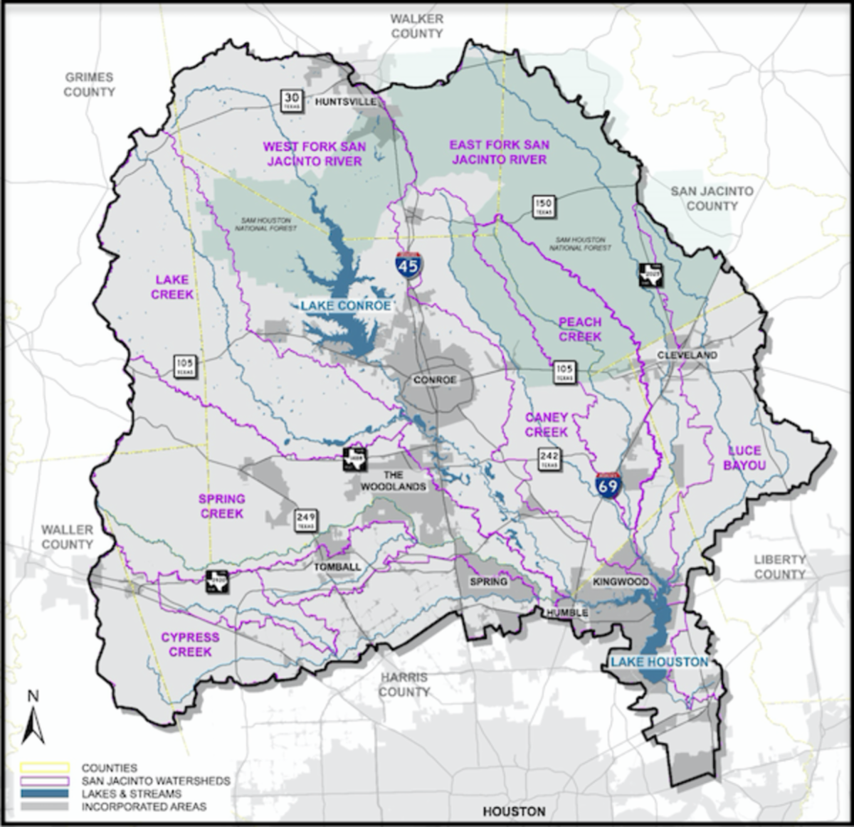
The study area includes the Upper San Jacinto River watershed which extends from the headwaters in Walker County to the Interstate 10 crossing at the San Jacinto River in Harris County. This area covers approximately 2,900 square miles of the watershed upstream of Interstate 10, located in seven different counties.
The 535 miles of major streams evaluated as part of this study include West Fork San Jacinto River, East Fork San Jacinto River, San Jacinto River, Lake Creek, Cypress Creek, Little Cypress Creek, Spring Creek, Willow Creek, Caney Creek, Peach Creek, Luce Bayou, Tarkington Bayou, and Jackson Bayou.
Strategies for short-term solutions include creating a vision group, standardizing policies, enhancing flood monitoring and warnings, improving flood response, acquiring property and removing it from potential flood risk, re-mapping floodplains, and conducting watershed protection studies for Spring, Caney, Peach, and Lake creeks and West Fork, Luce Bayou, and East Fork.
Potential long-term solutions could include construction of stormwater detention basins to lower water surface elevations downstream. Another solution is making channel conveyance improvements ranging from concrete-lined sections to man-made channels.